
Property Showcase Location Story Template
Use a Property Showcase sequence to approach one confirmed property and finish with an interactive orbit that explains its immediate setting.

Property Showcase is the simplest Georivo story structure: confirm one property, choose a suitable approach, and finish with an interactive orbit. It works when the listing needs a clear exterior and immediate-location introduction without a longer sequence of nearby places. It does not replace current photography, interior media, title information, or a coverage check for the exact address.

Audience and result
The Property Showcase template is built specifically for real-estate agents, property marketers, developers, hospitality teams, and destination teams who need to communicate a property's location and its surrounding context with absolute clarity. In real-estate marketing, establishing where a property sits in relation to its immediate environment is a critical step in introducing a listing to prospective buyers or guests. This template provides a clean, focused visual presentation that centers entirely on a single confirmed property, establishing its position relative to neighboring structures and the immediate streetscape without the distraction of a longer sequence of distant points of interest.
The final result of this template is an embeddable, interactive, photorealistic 3D location story. This visualization is generated using licensed geospatial imagery, creating a highly detailed 3D representation of the area. It is important to distinguish this digital 3D visualization from physical drone footage. While physical drone footage captures a static, pre-recorded video of the physical site at a specific moment in time, the Georivo 3D location story is an interactive digital environment. Once the programmed camera movements finish their playback, the system transitions into a live exploration mode, allowing the viewer to pan, tilt, zoom, and explore the surrounding neighborhood directly within the embed. This interactive capability encourages deeper engagement and allows prospective buyers to inspect the immediate setting at their own pace.
Required inputs
Creating a Property Showcase story requires very few technical inputs from the user, making it a highly accessible tool for busy marketing teams. The primary and most critical input is a single confirmed property address. The Georivo platform uses this address to locate the property within its licensed geospatial database and generate the corresponding 3D scene. Because the visualization is constructed entirely from existing high-resolution geospatial imagery, users do not need to upload complex architectural files, custom 3D models, or coordinates.
However, because the system relies on licensed geospatial imagery, a fundamental prerequisite is performing an address coverage check. Users must verify that the exact address is located within an area with supported 3D coverage before proceeding with their marketing campaigns. If the address is covered, the system can automatically generate the 3D environment. Beyond the address, the only other inputs are configuration choices, such as selecting a suitable camera approach and setting up the orbit sequence. This streamlined process eliminates the logistical challenges associated with physical aerial production, such as hiring drone operators, scheduling shoots around weather conditions, or navigating local airspace regulations.
Sequence
The Property Showcase template follows a structured, cinematic three-step sequence designed to guide the viewer's eye from a broad geographic context down to the specific property. This programmed camera path ensures a professional and consistent presentation for every listing.
The sequence begins by approaching the confirmed property. The camera starts from an elevated perspective and glides smoothly downward toward the target address. This initial approach phase establishes a clear sense of arrival and shows how the property fits into its wider community context.
The second step is to identify the location. As the camera nears the target, the visualization highlights the confirmed property, ensuring that the viewer can immediately identify the specific structure being showcased. This step is crucial for establishing clear visual context, especially in dense residential areas or commercial districts where individual properties can easily blend into the background.
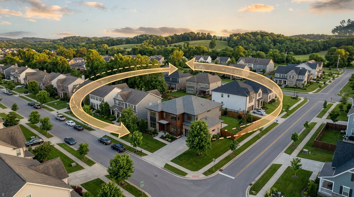
The final step of the sequence is to finish with an interactive orbit. The camera executes a programmed circular path around the property, showcasing its immediate setting from multiple angles. This orbit provides a comprehensive view of the property's exterior surroundings, neighboring structures, and street access. Once this automated camera movement is complete, the story transitions into live exploration mode, giving the viewer full control to interactively explore the surrounding neighborhood.
Configuration steps
Configuring a Property Showcase is a straightforward process within the Georivo creator interface, designed to let users customize the visual flow without needing advanced technical skills. The first step is to input the confirmed property address and perform the necessary coverage check to ensure the 3D environment can be generated. Once coverage is confirmed, the user can begin setting up the programmed camera movements.
The user can choose a suitable approach direction and camera angle to match the natural orientation of the property. For example, if a property has a particularly scenic view in one direction, the approach path can be configured to highlight that context as the camera glides downward. The user also configures the parameters of the final orbit, adjusting the camera path to ensure a smooth and steady rotation around the property.
After previewing the programmed camera path to verify that the transitions are smooth and the property is framed correctly, the user can finalize the story. The platform then generates the distribution assets, which include protected share links for direct sharing and domain-bound embed codes. These domain-bound embeds ensure that the interactive 3D story can only be displayed on authorized websites, protecting the user's digital assets from unauthorized distribution.

Worked example
To illustrate how this template functions in practice, consider an illustrative scenario involving a real-estate professional preparing a digital listing presentation for a single residential property. The professional's primary goal is to introduce the property's immediate location and exterior setting to online visitors without the logistical complexity of physical drone production.
The professional begins by entering the confirmed property address into the Georivo platform to perform an address coverage check. Once the system verifies that high-resolution 3D geospatial imagery is available for the location, the professional selects a suitable camera approach that glides smoothly toward the home. They program the camera movement to transition from this approach into a steady, circular orbit around the property, highlighting its immediate physical relationship to neighboring homes and the local streetscape.
After previewing the sequence to ensure the camera path is smooth, the professional generates a domain-bound embed code and integrates the interactive 3D story directly into the listing's web page. When prospective buyers visit the site, they experience the automated approach and orbit, which clearly identifies the property's location. Once the playback ends, the buyers use the live exploration feature to interactively pan and zoom around the surrounding area, gaining a clear understanding of the immediate setting before scheduling an in-person visit.
Customization
The Property Showcase template provides several customization options that allow real-estate professionals to tailor the visualization to their specific marketing needs while maintaining a consistent brand presentation. Users can customize the camera's programmed movements, adjusting the starting altitude, approach angle, and the speed of the camera path to create the desired visual pacing.
In addition to visual adjustments, the template supports advanced security and sharing configurations. Users can generate protected share links, which are ideal for sending directly to private clients or sharing within controlled email newsletters. For public-facing websites, the platform's domain-bound embeds allow users to restrict the interactive story to specific authorized domains. This feature ensures that your high-quality visualization assets remain secure and are only displayed on your official marketing channels, preventing competitors or unauthorized third-party sites from scraping or embedding your interactive content.
When not to use
While the Property Showcase template is an excellent tool for establishing immediate location context, it is important to understand its limitations and recognize when it should not be used. First and foremost, this template is a digital 3D visualization built from licensed geospatial imagery; it is not physical drone footage and does not show real-time physical conditions. It does not show property interiors, and it may not reflect recent exterior renovations, current paint colors, temporary structures, or the exact current state of the landscaping.
Because of these characteristics, this visualization does not replace current on-site photography, professional interior media, or official title information. It should always be used as a complementary marketing tool alongside up-to-date physical media. Furthermore, this visualization must never be used to represent legal property boundaries or official parcel lines, as it is designed strictly for contextual marketing and location storytelling, not for legal, surveying, or zoning purposes.
Additionally, this template is designed to focus on a single confirmed property and its immediate setting. If your marketing strategy requires highlighting a broader neighborhood context, such as a sequence of multiple nearby places, parks, schools, or transit stations, the Property Showcase template is not suitable. In those scenarios, you should use the Neighborhood Story template, which is specifically designed to handle multi-location sequences and broader community storytelling. Finally, if the target address does not pass the initial address coverage check, the visualization cannot be generated, and alternative media must be used.
Limitations and suitability
Use this material for presentation and decision support, not as a substitute for independently verified source information. Confirm routes, distances, access, availability, imagery, legal boundaries, platform requirements, and current conditions with the relevant authoritative source before publication or use.
Approved boundaries for this page: Requires supported 3D coverage; Does not show interiors or current exterior condition.
| Story Component | Input / Configuration | Role in Visualization | Platform Feature |
|---|---|---|---|
| Property Identification | Confirmed property address | Establishes the focal point of the location story | Address entry and coverage check |
| Camera Path | Programmed camera movements | Guides the viewer from an approach to an orbit | Configurable camera path |
| Distribution | Domain-bound embed | Restricts visualization to authorized websites | Domain restriction settings |
| Sharing | Protected share link | Allows secure direct sharing of the story | Link generation |
Steps to Deploy Your Property Showcase
- Enter the confirmed property address into the search bar.
- Verify the 3D coverage and check the initial camera marker placement.
- Select your preferred approach direction and camera glide angle.
- Set the orbit speed and radius to capture the immediate setting.
- Preview the programmed camera path to ensure smooth transitions.
- Generate the secure share link or copy the domain-bound embed code.
The Property Showcase template allows us to establish immediate geographic context without the logistical overhead of physical drone production.
FAQ
Does this template show the interior of the property?
No, the Property Showcase template focuses exclusively on the exterior location and surrounding neighborhood context using licensed geospatial imagery.
Can I use this template if the property is in an area without 3D coverage?
The template requires supported 3D coverage. You should perform an address coverage check in the system before planning your marketing campaign.
How does this differ from physical drone footage?
This is a digital 3D visualization built from licensed geospatial imagery, allowing viewers to interactively explore the scene after the playback ends, which static video cannot do.
Can I restrict where the interactive story is embedded?
Yes, Georivo supports domain-bound embeds, ensuring your interactive story only loads on your authorized website domains.
What inputs do I need to get started?
You only need a confirmed property address. The system automatically processes the location to generate the 3D environment.