
Why Off-Plan Buyers Need a Location Story Before They Can Trust the Render
Architectural renders show what a building will look like, but they cannot show where it actually sits. Discover why off-plan property buyers demand verified 3D location stories to build trust and accelerate sales.

Off-plan property buyers are asked to make the largest financial decisions of their lives based on idealized, context-free computer-generated imagery. While a beautiful interior render sells the aesthetic dream of a future residence, it inherently fails to answer critical questions about the physical world surrounding the future building. To bridge this trust gap, modern real estate marketers must look beyond the building facade and provide a verified, interactive location story that grounds the project in its true geographic context.
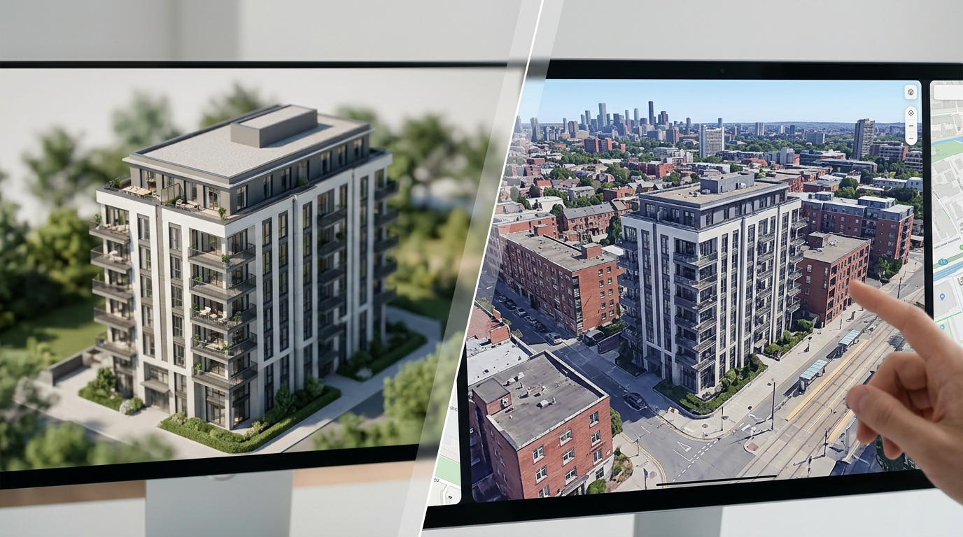
The Limits of the Architectural Render
Architectural renders are masterpieces of digital art. They use sophisticated lighting, high-end interior styling, and idealized weather conditions to present a future building in its absolute best light. However, these visualizations are intentionally self-contained. They focus almost exclusively on the physical structure of the building itself, often fading out the surrounding neighborhood into generic greenery, soft-focus backgrounds, or empty space. This isolation creates a significant psychological barrier for modern property buyers.
An off-plan buyer is not just purchasing a set of walls and high-end finishes; they are buying into a specific geographic coordinate. When a render hides the neighboring brick wall, the busy intersection, or the true height of adjacent structures, it inadvertently triggers buyer skepticism. Buyers today are highly analytical and quickly realize that an idealized image is only telling half the story. They need to know how the building interacts with the real world before they can commit to a purchase.
The Location Information Gap for Off-Plan Buyers
Buying off-plan requires a massive leap of faith. Without a physical structure to walk through, buyers must reconstruct the future living experience in their minds. To do this, they need to answer critical questions about the physical world surrounding the site. They want to know where the morning sun will hit, whether a neighboring building will block their view, and what the actual walk to the nearest train station looks like.
Traditional marketing materials rarely answer these questions with any precision. A static bulleted list of nearby amenities does not convey the topography of the walk or the safety of the route. By failing to provide this context, developers force buyers to do their own detective work. Buyers will search online maps, visit the physical site on weekends, or worse, abandon the purchase altogether out of frustration and uncertainty.

Why Static Maps and Flat PDF Brochures Fail
For decades, the standard solution to the location problem has been the 2D neighborhood map printed in a PDF brochure. These maps typically feature a simplified, stylized graphic with colored pins indicating local cafes, schools, and parks. While visually clean, these static maps lack scale, elevation, and real-world perspective. They make a steep uphill climb look identical to a flat stroll, and they often distort distances to make amenities appear closer than they are.
Modern buyers are highly sensitive to these distortions. They have grown accustomed to interactive, high-fidelity mapping tools in their daily lives. When presented with a flat, stylized map that looks like a cartoon, their trust in the developer decreases. They require a realistic, scale-accurate representation of the environment that allows them to verify distances and understand spatial relationships in three dimensions.
The Risk of the Visual Disconnect
When there is a disconnect between the idealized render and the physical reality of the site, developers face significant risks. If a buyer discovers that a beautiful view depicted in a render is actually blocked by an existing office building, the sales process stalls immediately. Trust, once broken in the early stages of a real estate transaction, is incredibly difficult to rebuild.
Beyond lost sales, this visual disconnect carries legal and reputational risks. Regulatory bodies globally are tightening rules around property advertising, demanding that representations of views and surroundings be accurate. Misleading renders can lead to costly post-completion disputes, negative reviews, and damage to the developer brand. Providing verified, objective location context alongside architectural renders is the most effective way to mitigate these risks.
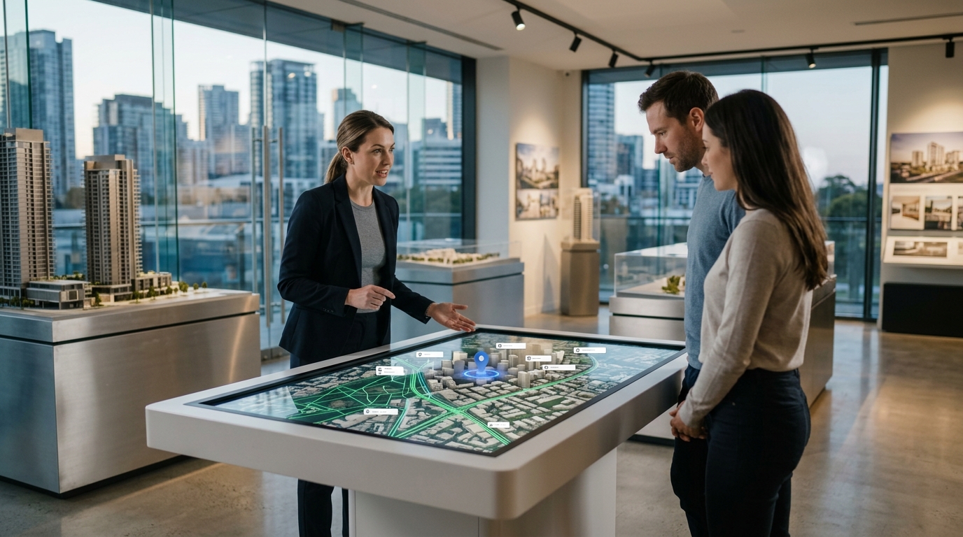
The Power of Interactive 3D Location Stories
To bridge the trust gap, progressive developers are turning to interactive 3D location stories. Unlike static renders or flat maps, a 3D location story uses licensed geospatial imagery to place the future building within its exact, unedited physical environment. This allows buyers to see the true height of neighboring buildings, the actual streets, and the genuine topography of the surrounding area.
It is crucial to distinguish this technology from physical drone footage. While drone videos provide real-world views, they are static, expensive to produce, and difficult to update as the project design evolves. A digital 3D location story, powered by platforms like Georivo, allows for prepare the automatic location presentation, live exploration after playback, and instant updates. Buyers can fly from the future apartment balcony to the local park, understanding the exact journey in a photorealistic virtual environment.
Differentiating Existing Context from Future Developments
One of the greatest challenges in off-plan marketing is representing future changes in the neighborhood. A vacant lot next door might be slated for a park, or it might be the site of a future high-rise. Ethical developers must navigate this uncertainty transparently. A 3D location story provides the perfect framework for this, allowing developers to show the existing physical context while clearly marking planned infrastructure or adjacent developments.
By clearly distinguishing what exists today from what is planned for tomorrow, developers build immense credibility. Instead of hiding potential changes, they can present them as part of the neighborhood evolution. This level of transparency reassures buyers that the developer is not hiding unpleasant surprises, which ultimately accelerates the decision-making process and fosters long-term satisfaction.
Integrating Location Stories into the Sales Funnel
Implementing a 3D location story is not just about adding a widget to a website; it is about transforming the entire sales journey. In the early awareness stage, short, programmed camera fly-throughs can be shared on social media or embedded in digital ads to capture attention. These animations show the project in relation to iconic local landmarks, instantly communicating its premium positioning.
During the consideration phase, sales agents can use interactive embeds on their website or on large screens in the sales gallery. Instead of pointing at a static physical model, agents can run a live exploration, walking the buyer virtually through the neighborhood. This interactive experience keeps buyers engaged longer, answers their questions in real-time, and provides the objective proof they need to sign the contract with confidence.
| Asset Type | Primary Focus | Location Accuracy | Buyer Interaction | Update Flexibility |
|---|---|---|---|---|
| Architectural Renders | Building aesthetics and interiors | Low (isolates or idealizes surroundings) | None (static images or fixed video) | Low (requires expensive re-rendering) |
| Static 2D Map PDFs | General neighborhood layout | Medium-Low (stylized, lacks scale and elevation) | None (flat graphic) | Medium (requires graphic design updates) |
| Physical Drone Footage | Real-world aerial context | High (shows actual current state) | None (fixed video playback) | Very Low (requires a new flight and edit) |
| Interactive 3D Location Stories | Verified building placement and neighborhood context | High (uses licensed geospatial imagery) | High (live exploration and programmed paths) | High (instant digital updates and camera changes) |
Five Steps to Build an Ethical Location Story for Your Off-Plan Project
- Gather accurate geospatial data and site coordinates for the future property.
- Identify key neighborhood landmarks, transit nodes, and lifestyle hubs within a two-kilometer radius.
- Build a photorealistic 3D environment that accurately represents existing neighboring structures.
- Program guided camera paths that simulate real-world journeys from the property to local amenities.
- Embed the interactive experience across all digital touchpoints, including the website and sales gallery screens.
In off-plan sales, the architectural render sells the dream of the home, but the location story sells the reality of the lifestyle. You cannot have sustainable trust without both.
FAQ
Why are architectural renders not enough for off-plan buyers?
Architectural renders focus on the building design and interiors, often omitting or idealizing the surrounding environment. Buyers need to understand the real-world context, such as neighboring building heights, sunlight orientation, and actual walking routes, which renders cannot show.
How does a 3D location story differ from physical drone footage?
While drone footage shows the real world, it is a static, non-interactive video that is expensive to shoot and difficult to update. A 3D location story is a dynamic digital experience using licensed geospatial imagery, allowing buyers to interactively explore the area and letting developers update camera paths instantly.
Can a 3D location story show future neighborhood developments?
Yes. A digital 3D location story allows developers to overlay planned infrastructure, parks, or neighboring buildings onto the existing geospatial model, helping buyers visualize the future neighborhood transparently and ethically.
How do interactive location stories improve sales gallery conversions?
They allow sales agents to address buyer objections about location instantly. Instead of pointing to a flat map, agents can run a live virtual tour of the neighborhood, demonstrating exact walking times and sightlines, which builds immediate trust.
What platforms are best for creating these interactive 3D experiences?
SaaS platforms like Georivo are designed specifically for real-estate professionals. They convert property addresses into embeddable, interactive photorealistic 3D location stories using licensed geospatial imagery, without the need for complex custom software development.
Is it difficult to integrate 3D location stories into existing real estate websites?
No. Modern platforms provide domain-bound embeds and protected share links, making it as simple as embedding a standard video player. They work seamlessly across desktop, mobile, and large sales gallery touchscreens.