Check 3D Property Flyover Coverage for an Address

Check whether a property address has the photorealistic 3D coverage required for a live Georivo location story before configuring or publishing it.

Check a property address

Real provider response. No raw address is sent to analytics.

Georivo checks the exact property coordinates against the configured Google-based coverage evidence before it marks an address as available. A city may contain photorealistic 3D imagery while a specific parcel does not, so availability must be tested point by point. If the address is ambiguous, the user can correct the point on a real map and run the check again.

Georivo coverage checker interface showing an address input and map viewport
The Georivo interface allows users to input a formatted address and view the real-time coverage status.

What the coverage result means

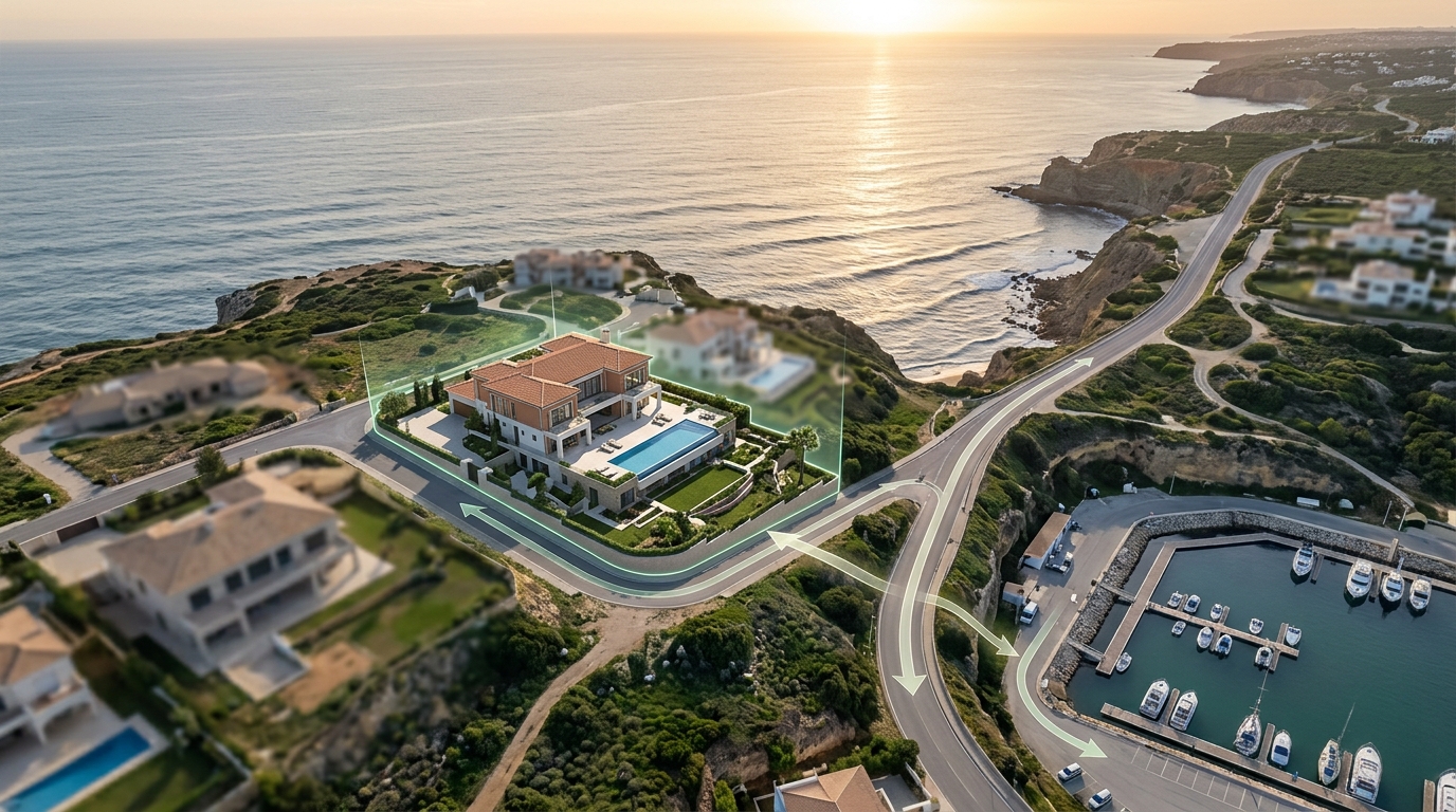
A Georivo coverage check evaluates whether a specific property address has the required photorealistic 3D data to construct an interactive location story. This check is a precise coordinate-level verification that determines if our rendering engine can access licensed three-dimensional geometry, which is essential for executing programmed camera movements and enabling live exploration after playback.

A successful coverage check confirms that the system can generate a complete interactive experience with realistic buildings, vegetation, and terrain. This visualization must be clearly distinguished from physical drone footage; while drone footage requires physical deployment and manual flight operations to capture video, Georivo uses pre-existing licensed geospatial imagery to generate a digital, interactive 3D environment.

Why Georivo checks an exact point

Broad geographic generalizations often fail in real-estate marketing. A municipality might contain extensive 3D mapping coverage, yet a specific parcel situated near a municipal border, a geographic transition, or a restricted zone may be completely excluded from the dataset. Georivo avoids these discrepancies by checking the exact latitude and longitude coordinates of the property rather than inferring availability from a city-level screenshot.

This point-by-point verification prevents marketers from committing resources to a campaign only to discover that the specific listing cannot be rendered in 3D. By querying the precise coordinates, the platform ensures that the immediate surroundings of the building are fully modeled in three dimensions before any configuration or publishing occurs, ensuring camera movements sweep over high-fidelity 3D mesh.

Interactive map with a draggable pin for precise coordinate correction
Users can drag the map pin to correct ambiguous geocoding and trigger a fresh 3D coverage check.

How to check a property address

The verification workflow begins when a user inputs a formatted property address into the system. The platform processes this input through a geocoding service to retrieve the authoritative latitude and longitude coordinates. This step is crucial because text-based addresses can often be formatted in multiple ways or contain minor spelling errors, which could lead to inaccurate mapping if not resolved programmatically.

Once the precise coordinates are established, the system checks the country code to ensure compliance with regional policies. If the location passes this initial policy filter, the platform queries the configured licensed 3D provider evidence to verify the presence of photorealistic surface mesh at those exact coordinates. The system evaluates these inputs to determine the final availability status.

Available, unavailable, unsupported, and technical-error states

The coverage check returns one of four distinct system states. The first state is 'Available', which is only granted after successful provider evidence confirms that high-resolution 3D mesh is present. This state allows users to proceed with configuring camera movements. The second state is 'Unavailable', which occurs when the exact point lacks sufficient photorealistic 3D surface coverage, meaning the provider does not have three-dimensional models for that specific parcel.

The third state is 'Unsupported Region', triggered when the product regional policy excludes the country where the property is located. The final state is 'Technical Error', which occurs when the provider or required configuration cannot be reached or verified. It is vital for users to understand that a technical error must not be presented as an unavailable address; instead, it indicates a temporary communication issue.

Side-by-side comparison of photorealistic 3D mesh coverage versus flat terrain
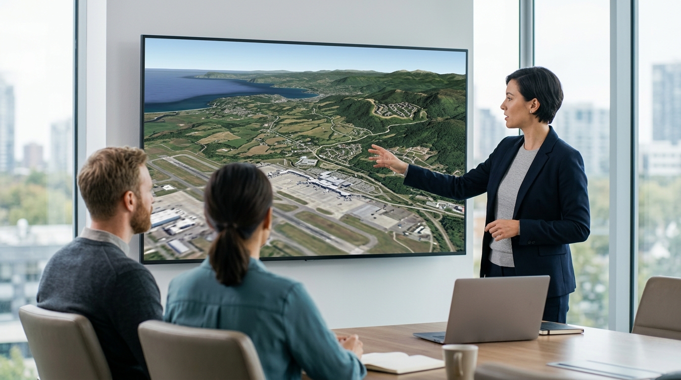
A successful coverage check confirms the presence of detailed 3D surface mesh rather than simple terrain elevation.

Correcting an ambiguous address on the map

Automated geocoding is highly efficient, but it is not infallible. Occasionally, a search for a formatted address might place the map pin on the street in front of the property, on an adjacent parcel, or in the center of a large postal zone rather than on the actual building. This ambiguity can lead to an inaccurate coverage result if the geocoded point falls just outside the covered 3D mesh boundary.

To resolve this, Georivo provides an interactive map interface where users can inspect the exact placement of the pin. If the pin is misaligned, the user can manually drag and drop it to the correct position directly over the target building. This manual correction updates the authoritative latitude and longitude coordinates in real time and automatically triggers a fresh coverage check.

Coverage, imagery quality, and recency

The quality and visual appeal of a Georivo location story depend directly on the underlying geospatial data. The photorealistic 3D mesh is constructed using advanced aerial photogrammetry, which combines multiple high-resolution images taken from aircraft to create detailed three-dimensional models of the physical world. This licensed imagery provides a clean, consistent, and legally compliant visualization suitable for professional marketing.

Because this imagery is gathered via scheduled aerial surveys, it represents historical data rather than a live, real-time view of the property. Users must keep in mind that recent construction, landscaping changes, or seasonal variations may not be immediately visible in the rendered environment. Additionally, because the provider imagery is not a live inspection of the property, it cannot be used for real-time condition assessments.

What to do when coverage is unavailable

If a coverage check returns an Unavailable or Unsupported status, marketing teams must adapt their strategy. When a specific parcel lacks 3D coverage, one option is to check if the surrounding neighborhood has coverage. If the broader area is modeled in 3D, you can still create a compelling location story by placing the starting point in the covered zone and using 2D markers for the property itself.

If the entire region lacks 3D data, you will need to rely on traditional media assets such as professional ground photography, standard 2D satellite maps, or physical drone footage. While physical drone production requires hiring a licensed pilot, obtaining permits, and waiting for clear weather, it remains the primary alternative when digital 3D visualization is not technically possible due to a lack of provider data.

Limitations and suitability

While Georivo is a powerful tool for visual storytelling, users must operate within its technical and legal boundaries. Coverage is evaluated strictly for the selected point and is not inferred from a city-level screenshot or regional claim. This means that individual parcels must be verified independently before any client commitments are made. Furthermore, these visualizations do not show or prove legal property boundaries and should not be used for legal surveys.

Additionally, terrain-only coverage is not sufficient for a photorealistic property flyover. If the provider database only contains elevation data without building and vegetation models, the platform will not mark the address as available. Additionally, availability can change when provider coverage or product policy changes, meaning previously verified points should be checked before starting new campaigns.

Users must also adhere to regional policies: Ukraine and Russia are completely unsupported. Africa is unsupported except South Africa, and Asia is unsupported except Japan. Finally, if a technical error occurs during a check, it must not be treated as an unavailable address, as it represents a temporary system interruption rather than a lack of 3D data.

System StateMeaningUser Action RequiredRegional Policy / Condition
AvailableThe exact coordinates have confirmed photorealistic 3D mesh data.Proceed to configure camera movements and publish the location story.Supported globally where provider data exists.
UnavailableThe exact coordinates lack sufficient photorealistic 3D surface coverage.Adjust the map pin or use alternative 2D presentation methods.Applies to areas without 3D photogrammetry.
Unsupported RegionThe country is excluded from the product regional policy.Verify if the property is located in an excluded territory.Ukraine and Russia are unsupported. Africa is unsupported except South Africa. Asia is unsupported except Japan.
Technical ErrorThe provider or required configuration cannot be reached or verified.Wait and retry the check. Do not treat this as an unavailable address.Occurs during temporary network or API communication failures.

Steps to Verify and Correct Address Coverage

  1. Enter the formatted property address into the Georivo search input field.
  2. Select the matching address from the Google-suggested autocomplete dropdown.
  3. Review the initial coverage status returned by the automated coordinate check.
  4. If the status is ambiguous, inspect the map pin placement on the interactive viewport.
  5. Drag and drop the map pin to the exact center of the property parcel to correct the coordinates.
  6. Trigger a re-evaluation of the coverage status based on the updated latitude and longitude.
Verifying 3D coverage at the exact parcel level before starting production ensures that every camera movement renders with photorealistic precision rather than falling back to flat terrain.
Georivo

Explore Georivo

FAQ

How does Georivo determine if an address has 3D coverage?

Georivo checks the exact latitude and longitude coordinates of the address against configured Google-based coverage evidence. This ensures that the specific parcel has photorealistic 3D mesh data available before you begin building your location story.

Can I use Georivo for properties in any country?

No. Georivo enforces regional policies. Currently, Ukraine and Russia are unsupported. Africa is unsupported except for South Africa, and Asia is unsupported except for Japan.

What is the difference between terrain-only coverage and photorealistic 3D coverage?

Terrain-only coverage only provides elevation data, which results in flat satellite images stretched over hills. Photorealistic 3D coverage includes detailed 3D models of buildings, trees, and structures, which is required for a high-quality Georivo flyover.

What should I do if I get a technical error during the coverage check?

A technical error indicates that the 3D provider or required configuration could not be reached. You should wait and retry the check later. It is important not to treat a technical error as an unavailable address.

Does Georivo show real-time live footage of the property?

No. Georivo uses licensed historical geospatial imagery. It is not a live inspection tool and does not show real-time conditions, active construction, or daily weather changes.

Why is an address marked as unavailable if the city has 3D coverage?

3D coverage is evaluated point by point. Even within a city that has extensive photorealistic imagery, specific parcels near boundaries, military zones, or complex terrain may lack sufficient 3D surface coverage.

Build your location story

Turn a property address into a live 3D journey.

Check a property address