
Mountain Property Location Story Example
Review a demo mountain-property arrival story that explains terrain and general approach without presenting it as navigation or current access evidence.

This demo shows how a mountain-property location story can orient a buyer using a valley or landmark, the general approach, an entrance reference, and the confirmed property. It is not turn-by-turn navigation or proof of present road access, weather, safety, legal access rights, or property condition. Those details require current authoritative sources and local verification.
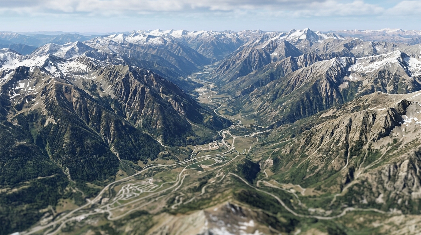
Demo disclosure
This article presents an illustrative demonstration of a mountain property location story created using Georivo. It is important to emphasize that this is a hypothetical demo and not an actual customer case or a representation of a specific real-world property listing. This visualization is designed to show how real estate professionals, property marketers, developers, hospitality teams, and destination teams can use licensed geospatial imagery to explain complex high-altitude terrain and general approach contexts. It does not represent active real estate inventory, nor does it depict verified physical conditions of any specific site.
A critical distinction must be made between this digital 3D visualization and physical drone footage. While physical drone footage captures real-time physical conditions of a property and its immediate surroundings at a specific moment, it is subject to physical limitations, weather conditions, local flight permissions, and operational constraints. In contrast, Georivo utilizes licensed geospatial imagery to construct a simulated 3D environment. This software-driven visualization is an illustrative representation of terrain and general geographic relationships, rather than a live-action or real-time recording of the physical site.
Live or poster demonstration
The Georivo platform supports multiple presentation formats to help real estate professionals communicate spatial context to their audiences. The primary interactive format is an embeddable interactive photorealistic 3D location story. This embed can be bound to specific domains to ensure secure integration on listing websites, allowing users to view prepare the automatic location presentation and then transition to live exploration after playback. Through this interactive experience, viewers can explore the surrounding terrain and nearby places from different angles, gaining a better understanding of the property's general setting.
In addition to the live interactive player, the platform's visualization capabilities can be presented in static or non-interactive formats, such as poster images or pre-rendered visual sequences. These formats are useful for print brochures, email campaigns, and other marketing materials where interactive web elements are not supported. By offering both interactive embeds and static visual representations, the platform allows marketers to choose the delivery method that best fits their specific communication channels, while maintaining a consistent focus on explaining the property's general geographic context.

Mountain scenario
Marketing a mountain home with a complex access context presents specific communication challenges for real estate agents and property marketers. Traditional photography and standard 2D maps often struggle to convey the reality of high-altitude terrain, elevation changes, and the relative positions of landmarks. A mountain property location story helps address these challenges by providing a photorealistic 3D representation of the landscape. This allows prospective buyers, especially remote buyers who cannot easily visit the location in person, to visualize the spatial relationships between the property and its surrounding environment.
In a typical mountain scenario, the physical relationship between a home and the surrounding topography is a key piece of information for interested parties. By utilizing licensed geospatial imagery, a location story can depict the steepness of slopes, the presence of nearby peaks, and the general layout of the valley. This visual context helps viewers understand the setting of the property without requiring them to interpret complex topographical maps or rely solely on static ground-level photographs, which may fail to capture the broader geographic landscape.
Selected points
To construct a clear spatial narrative for a mountain property, the location story is organized around several selected points that guide the viewer through the landscape. These points are chosen to establish a logical progression from a broad regional view down to the specific property. In this illustrative demo, the selected points include a valley or landmark, an approach, an entrance reference, and the confirmed property itself. Each of these points serves a specific role in orienting the viewer and explaining how the property sits within the wider mountain environment.
The first selected point is a prominent valley or landmark, which serves as an initial macro-level reference to help viewers orient themselves geographically. The second point is the approach, which visualizes the general route or path leading toward the property through the terrain. The third point is an entrance reference, which marks the transition point from the general approach to the immediate vicinity of the property. Finally, the fourth point is the confirmed property itself, allowing the viewer to see the specific building or lot in relation to its immediate physical surroundings and topography.
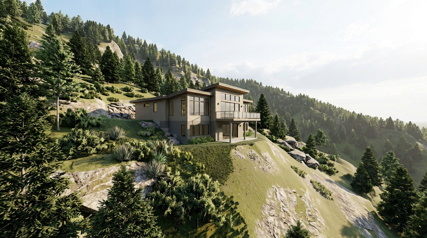
Arrival logic
The sequence of these selected points follows a deliberate arrival logic designed to orient the viewer step-by-step. By starting the visualization at a recognizable valley or landmark, the camera establishes a broad sense of place before moving closer to the property. This macro-to-micro progression is essential for helping remote buyers understand the general layout of the region. The prepare the automatic location presentation transition smoothly from the initial landmark, along the general approach, past the entrance reference, and finally to the confirmed property, creating a cohesive visual flow.
This structured arrival sequence helps viewers conceptualize the general journey to the property without overwhelming them with disconnected visual fragments. By presenting the terrain in a continuous, logical order, the location story provides a clear explanation of how the property is situated relative to the surrounding landscape. This approach is particularly useful for explaining complex access contexts, where the physical relationship between the property, the main access routes, and nearby geographical features might otherwise be difficult to understand.
Buyer learning
Through this illustrative location story, prospective buyers can learn about the general spatial context of the mountain property in a way that traditional marketing materials cannot replicate. They can observe the elevation of the property, its orientation relative to the sun and surrounding slopes, and its proximity to key natural features. This visual information helps buyers develop realistic spatial expectations before they schedule an in-person visit or proceed with further inquiries, which is especially valuable for remote buyers managing properties from a distance.
By interacting with the 3D visualization and exploring the surrounding area after the programmed playback, buyers can gain a better understanding of the neighborhood and nearby places. They can identify the general locations of local roads, valleys, and other points of interest. This self-guided exploration allows buyers to address their own questions about the property's setting, helping them feel more informed and confident as they evaluate whether the location meets their specific needs and preferences.
Access limitations
It is critical to understand that this mountain property location story is an illustrative visualization and not a tool for turn-by-turn navigation or a guarantee of physical access conditions. The 3D geospatial imagery used to generate the story is historical and does not provide real-time information regarding current road conditions, seasonal weather effects, snow cover, road safety, or temporary blockages. Furthermore, the visualization does not prove the existence of legal access rights, easements, or property boundaries. These legal and physical details must be verified through official documentation and professional services.
Marketers and buyers must not rely on this digital representation as evidence of a property's current physical state, structural integrity, or accessibility. The visualization is designed solely to explain general terrain and geographic relationships. To confirm actual road safety, legal access, easement boundaries, and the physical condition of the property, interested parties must consult authoritative local sources, obtain professional land surveys, conduct physical site inspections, and review title reports with qualified legal and real estate professionals.
Build notes
Creating a mountain property location story involves a straightforward workflow within the Georivo platform. The process begins by entering a confirmed property address to verify licensed 3D geospatial imagery coverage. Once coverage is confirmed, the user can select key points of interest, such as a valley, landmark, approach route, and entrance reference, to define the narrative path. The platform then allows the user to prepare the automatic location presentation and paths to guide the viewer smoothly through the selected points, highlighting the unique topographical features of the mountain terrain.
After configuring the camera movements and points of interest, the platform generates a secure, domain-bound embed link or a protected share link. This allows real estate professionals to easily integrate the interactive 3D story into their listing websites or share it directly with prospective buyers. The workflow is designed to be accessible to property marketers, developers, and hospitality teams, providing a consistent and scalable way to communicate spatial context without the need for complex drone operations or specialized video production equipment.
| Visual Element | Source Type | Purpose | Verification Duty |
|---|---|---|---|
| Valley or landmark | Geospatial Imagery | Establish regional context | None, illustrative only |
| Approach | Programmed Camera Path | Show general terrain flow | Local road conditions check |
| Entrance | 3D Anchor | Identify property transition | Physical boundary survey |
| Property | Licensed 3D Tiles | View elevation and slope | Professional home inspection |
Steps to Configure a Mountain Property Location Story
- Input the confirmed property address into the Georivo platform to verify 3D coverage.
- Identify a prominent valley or landmark to serve as the initial macro anchor.
- Map the general approach path to illustrate the surrounding terrain and elevation.
- Set an entrance reference point to mark the transition from public roads to the property.
- Program the final camera movement to focus directly on the confirmed property.
- Review and customize the camera angles to ensure the slope and terrain are clearly visible.
- Generate a protected share link or domain-bound embed code for your listing website.
Using interactive 3D location stories allows remote buyers to comprehend complex mountain topography long before their first physical visit, establishing realistic spatial expectations.
FAQ
Does this mountain property location story provide turn-by-turn driving directions?
No. This story is an illustrative spatial visualization designed to show general terrain and approach context. It does not function as turn-by-turn navigation or GPS guidance.
Can this visualization prove that a mountain road is currently open or safe?
No. The 3D imagery is based on historical licensed geospatial data and does not reflect real-time weather, road closures, seasonal blockages, or safety conditions.
How does this differ from physical drone footage?
Unlike physical drone footage, which requires on-site operators, permits, and favorable weather, Georivo uses licensed 3D geospatial imagery to generate programmed camera paths instantly from any web browser.
Is the property boundary shown in the demo legally binding?
No. The property markers and entrance references are for illustrative purposes only. Accurate legal boundaries must be verified through official land surveys and deed records.
Can I use this visualization as proof of legal access rights?
No. Access rights, easements, and road maintenance agreements must be verified through title companies and local municipal records.
What templates are available for setting up this type of visualization?
Georivo offers The current product automatically prepares the location presentation after the exact property is confirmed.